Paris bus maps and timetables for bus lines 40 through to 49


Below you will find the Paris bus maps showing bus stops, transport connections, routes and timetables for bus lines 40 through to 49, which are available in PDF and image file formats, as well as in large or small file sizes, making these ideal for any mobile device or PC.

Paris bus maps - Central Bus Lines  01-09  10-19  20-29  30-39  40-49  50-59  60-69  70-79  80-89  90-99  100-109  110-119  120-129  130-139  140-149  150-159  160-169  170-179  180-189  190-199  200-209  210-219  220-229  230-239  240-249  250-259  260-269  270-279  280-289  290-299  300-309  310-319  320-329  330-339  340-349  350-359  360-369  370-379  380-389  390-399  400-409  420-429  430-439  440-449  450-459  460-469  470-479  480-489  490-499  500-509  510-519  520-529  530-539  540-549  550-559  560-569  570-579  580-589  590-599  610-619  620-629  700-709  Abeilles Buses  Batobus  Big Bus  DM Buses  Express A14  Fileo Buses CDG1  GO C Orly Shuttle Bus  Le Bus Direct  Magical Shuttle  OrlyBus  R4 Bus  RoissyBus  T'Bus CDG1  TICE Buses  Tootbus  TVM Bus  TZen Buses  Versailles Express  Vitavil  -  Noctilien Night Buses

RATP Paris bus line 40 with stops, connections and route plan

Paris bus 40 map with stops and connections
This first Paris Bus route map features RATP line 40 that has been extended and has additional bus stops in order to replace the Montmartrobus, so it now connects between Le Peletier and Mairie du 18e - Jules Joffrin, which have stops such as Saint-Georges, Pigalle, Abbesses, Chappe, Tourlaque, Moulin de la Galette, Place du Tertre-Norvins, Utrillo, Les Vignes, Lamarck-Caulaincourt, Marcadet and more.

Paris bus line 40 stops:


Le Peletier, Carrefour de Chateaudun, Saint-Georges - Chateaudun, Saint-Georges, Gustave Toudouze, Navarin, Rochechouart - Martyrs, Pigalle, Martyrs, Orsel, Abbesses, Yvonne Le Tac, Durantin - Burq, Tholoze, Chappe, Drevet, Tourlaque, Gabrielle, 88, rue Lepic, Moulin de la Galette, Funiculaire, Place du Tertre - Norvins, Utrillo, Abreuvoir - Girardon, Mont-Cenis - Cortot, Saules - Cortot, Chevalier de la Barre, Les Vignes, Lamarck - Becquerel, Lamarck - Mont-Cenis, Lamarck - Caulaincourt, Custine - Mont-Cenis, Custine - Ramey, Marcadet, Mairie du 18e - Jules Joffrin.

Paris bus line 40 main transport connections:


Metro Lines: 2, 7, 12.

Paris bus 40 route maps available:


RATP Bus Line 40 map - PDF (standard quality - 0.487 MB)
RATP Bus Line 40 map - PDF (high quality - 1.327 MB)
RATP Bus Line 40 map - Image (standard quality - 0.439 MB)
RATP Bus Line 40 map - Image (high quality - 0.783 MB)

Paris bus 40 timetables:


RATP Bus 40 timetables - PDF (0.422 MB)
RATP Bus 40 timetables - Image (1.098 MB)

Paris bus 40 map for Gare Fontenay-le-Fleury to Gare Versailles Chantiers Gare Routiere with stops and transport connections

Paris bus 40 map Versailles with stops and connections
Although here you have another bus line 40 that is run by the transport company Stavo in the Paris region and has a bus route from Gare Versailles Chantiers - Gare Routiere going through the commune or area of Saint-Cyr-l'Ecole to Gare, which is the train station in Fontenay-le-Fleury. Also, as you will see from the bus 40 timetables and route plan, there are two stops only served in a particular direction and some times are not served during specific holiday periods.

Paris bus line 40 Versailles stops:


Fontenay-le-Fleury - Gare, Lamartine*, Pompidou*, Hotel de Ville, Reinette, Jean Lurcat, Schweitzer, Cesar Frank, Jean-Pierre Timbaud, Fontaine Saint-Martin, Lycee Mansart, Charles Renard, J.B. Lully, Le Clos St Cyr, Docteur Vaillant, Republique, Division Leclerc, I.N.R.A., Les Matelots, Orangerie, Rue de Satory, Gare Versailles Chateau Rive Gauche - Sceaux, Gare de Versailles Chantiers - Gare Routiere.

* Stop only served in one direction.

Paris bus line 40 main transport connections:


Train Lines: C, N, U.

Paris bus 40 Versailles route maps available:


Paris Bus 40 Versailles map - PDF (standard quality - 0.408 MB)
Paris Bus 40 Versailles map - PDF (high quality - 0.673 MB)
Paris Bus 40 Versailles map - Image (standard quality - 0.372 MB)
Paris Bus 40 Versailles map - Image (high quality - 0.635 MB)

Paris bus 40 Versailles timetables:


Paris Bus 40 Versailles timetables - PDF (3.855 MB)
Paris Bus 40 Versailles timetables - Image (3.387 MB)
Paris bus 42 stop Rue Royale

Paris Transdev bus line 40 Rueil Malmaison to Suresnes with stops, connections and street plan

Paris Transdev bus 40 map with stops and connections
Here we have the geographical map and timetables for the Transdev bus line 40 that goes from Suresnes - Pompidou to Rueil-Malmaison at either Passy Buzenval or St Cucufa, and from these two points to a different terminus of Suresnes - Commandant Riviere in the opposite direction, only operating on a Monday to Friday during the academic year at key times in the morning and early evening.

Paris Transdev bus line 40 stops:


St Cucufa (Madeleine Danielou)***, Passy Buzenval***, Cimetiere, Eglise de St Cloud, Montretout, Lycee Alexandre Dumas, Marie Bonaparte, La Berangere, Val d'Or, Garibaldi, Suresnes Longchamp Gare T2, De Gaulle, Henri IV*, Jean Mace*, Mairie**, Pages**, Pompidou*, Commandant Riviere**.

* Served in direction of St Cucufa or Passy Buzenval.
** Served in direction of Commandant Riviere.
*** Only served at specific times.

Paris Transdev bus line 40 main transport connections:


Bus Lines: 12, 37, 38, 93, 111, 141, 144, 175, 241, 244, 467, 544, 563, N53.
Tram Line: T2.

Paris Transdev bus 40 route maps available:


Transdev Bus Line 40 map - PDF (1.380 MB)
Transdev Bus Line 40 map - Image (1.136 MB)

Paris Transdev bus 40 timetables:


Transdev Bus 40 timetables - PDF (0.524 MB)
Transdev Bus 40 timetables - Image (1.520 MB)

Phebus Paris bus line 40 map Inovel Park Nord to Pont de Sevres with stops and transport connections

Paris bus 40 map Inovel Park Nord to Pont de Sevres
Yet here we have the Bus line 40 run by the transport company Phebus that travels from Boulogne-Billancourt at the Pont de Sevres within walking distance of many popular tourist attractions including the Sevres Museum, Parc Saint-Cloud and La Seine Musicale entertainment venue. Running on a Monday to Friday the bus route travels through to Velizy-Villacoublay at Inovel Parc Nord, but please take note of the maps and timetables as there are some stops only served in one direction.

Phebus Paris bus line 40 stops:


Pont de Sevres, Morane**, Pasteur, Copernic, Le Bois, La Cheminee, Nieuport*, Grange Dame Rose**, Residence Europe**, Traite de Rome**, Inovel Parc Nord.

* Stop served in the direction of Inovel Parc Nord.
** Stop served in the direction of Pont de Sevres.

Phebus Paris bus line 40 main transport connections:


Metro line: 9.
Tram line: T6.

Phebus Paris bus 40 route maps available:


Phebus Bus Line 40 map - PDF (0.333 MB)
Phebus Bus Line 40 map - Image (0.458 MB)

Phebus Paris bus 40 timetables:


Phebus Bus 40 timetables - PDF (0.932 MB)
Phebus Bus 40 timetables - Image (2.099 MB)

RATP Paris bus line 42 with stops, connections and street plan

Paris bus 42 map with stops and connections
This map shows the Paris Bus route for the RATP line 42 that travels Cours de l'lle Seguin and the Gare Saint-Lazare train station with its additional bus stops on route like Place Jules Guesde, Pont du Gariglian, Hopital Europeen-Georges Pompidou, Lourmel-Felix Faure, Rond-Point Saint-Charles, Champ de Mars - Suffren, Tour Eiffel, Alma - Marceau, Champs-Elysees - Clemenceau, Concorde and Madeleine to name a few.

Paris bus line 42 stops:


Cours de l'Ile Seguin, Parch de Billancourt, Place Jules Guesde, Marche de Billancourt, Marcel Sembat - Metro, Rene Descartes, Henri Martin, Porte de Saint-Cloud, Porte de Saint-Cloud-Murat, Versailles - Chardon Lagache, Versailles Exelmans, Pont du Garigliano, Hopital Europeen - Georges Pompidou, Rue Leblanc (Entree Principale de l'Hop.), Leblanc - Delbarre**, Place Balard, Balard - Lecourbe*, Saint-Charles - Balard**, Lecourbe - Vasco de Gama*, Vasco de Gama - Lourmel*, Lourmel - Felix Faure*, Rond-Point Saint-Charles**, Convention - Saint-Charles**, Convention - Lourmel*, Charles Michels, Theatre, Rue Rouelle, Docteur Finlay**, Dupleix, Desaix, Champ de Mars - Suffren, Rapp - La Bourdonnais, Monttessuy, Tour Eiffel, Bosquet - Rapp, Alma - Marceau, Montaigne - Francois 1er, Rond-Point des Champs-Elysees, Champs-Elysees - Clemenceau, Concorde - Cours la Reine, Concorde*, Concorde - Royale**, Madeleine - Malesherbes*, Madeleine*, Havre - Haussmann, Gare Saint-Lazare - Havre*, Gare Saint-Lazare.

* Stop served in the direction of Cours de l'Ile Seguin.
** Stop served in the direction of Gare Saint-Lazare.

Paris bus line 42 main transport connections:


Metro Lines: 1, 3, 6, 8, 9, 10, 12, 13, 14.
Train Lines: C, E, J, L.
Tram Line: T3a.

Paris bus 42 route maps available:


RATP Bus Line 42 map - PDF (standard quality - 0.636 MB)
RATP Bus Line 42 map - PDF (high quality - 1.811 MB)
RATP Bus Line 42 map - Image (standard quality - 0.586 MB)
RATP Bus Line 42 map - Image (high quality - 1.043 MB)

Paris bus 42 timetables:


RATP Bus 42 timetables - PDF (0.440 MB)
RATP Bus 42 timetables - Image (1.246 MB)

Phebus Paris bus line 42 map L'Onde Maison des Arts to Pont de Sevres with stops and transport connections

Paris bus 42 map L'Onde Maison des Arts to Pont de Sevres
This shows the maps and timetables for the Paris bus line 42 run by the transport company Phebus that travels between Boulogne-Billancourt - Pont de Sevres and Velizy-Villacoublay - L'Onde Maison des Arts, and operating on a Monday to Friday you will see that this route goes through different communes or areas and different ticket tariff zones including Bievres in Zone 4.

Phebus Paris bus line 42 stops:


Pont de Sevres, Rond-Point Val de Grace, Base Aerienne 107, Burospace, Les Ailes, Les Helices, Route Militaire, General Valerie Andre, Zone Aeronautique, Pointe Ouest, Echangeur (Zone 4), L'Onde Maison des Arts.

Phebus Paris bus line 42 main transport connections:


Metro line: 9.
Tram line: T6.

Phebus Paris bus 42 route maps available:


Phebus Bus Line 42 map - PDF (0.769 MB)
Phebus Bus Line 42 map - Image (0.500 MB)

Phebus Paris bus 42 timetables:


Phebus Bus 42 timetables - PDF (1.051 MB)
Phebus Bus 42 timetables - Image (2.375 MB)

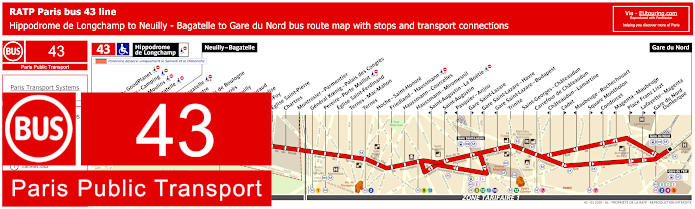
Disneyland Paris bus 43 map Gare de Marne-la-Vallee to Gare de Val d'Europe with stops, connections and street plan

Disneyland Paris bus 43 map with stops and connections
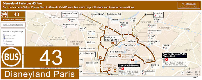
This Paris bus line is run by Transdev and AMV, travelling between Gare de Val d’Europe and Gare de Marne-la-Vallee Chessy Nord, just a short distance from Disneyland Paris. This line has different timetables between weekdays, Saturday's, Sundays and public holidays, and is worth noting that some of the stops here are not disabled friendly. Additionally, there are some point routes, in directions for College du Vieux Chene, Coteaux RD934 and Calvaire which run at specific times during school term times.

Disneyland Paris bus 43 line stops:


Gare de Val d'Europe, Fontaine Rouge (acces RER)**, Prague, Eugene Isabey, Louis de Vion, Buffard, Bois de Loselet, Parc du Mont Evrain, Binaches, Bicheret, Sophora, Fontaine au Roi, Glaciere, Mairie de Chessy, Artisans, Ecoles, Parking Nord, CAMSP, Santa Fe*, Sequoia Lodge**, Gare de Marne-la-Vallee Chessy Nord, Coteaux RD934***, Alembert***, Cabane Noire***, Bonne Auberge***, Mairie***, Calvaire***, Vaillant***, Chateau***, Louis Pasteur***, St Eloi***, Tournelles***, College du Vieux Chene***, College Lucie Aubrac***.

* Only served in the direction of Gare de Marne-la-Vallee Chessy Nord.
** Only served in the direction of Gare de Val d'Europe.
*** Point stops only served at specific times.

Disneyland Paris bus 43 main transport connections:


Train line: A.
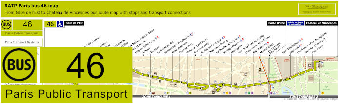
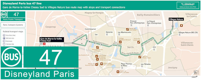
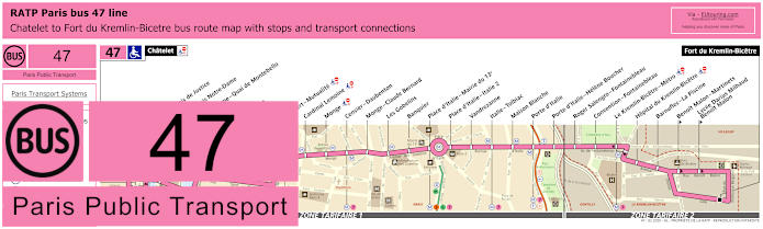
Bus lines: 02, 6, 12, 13, 16, 17, 18, 19, 22, 23, 24, 32, 34, 35, 38, 42, 46, 47, 50, 57, 58, 59, 60, 62, 69, Magical Shuttle CDG, Magical Shuttle Orly, N130, N141.

Disneyland Paris bus 43 route maps available:


Disneyland Paris Bus 43 map - PDF (standard quality - 0.627 MB)
Disneyland Paris Bus 43 map - PDF (high quality - 1.484 MB)
Disneyland Paris Bus 43 map - Image (standard quality - 0.638 MB)
Disneyland Paris Bus 43 map - Image (high quality - 1.083 MB)

Disneyland Paris bus 43 timetables:


Disneyland Paris Bus 43 timetables - PDF (7.030 MB)
Disneyland Paris Bus 43 timetables - Image (6.351 MB)

RATP Paris bus line 43 with stops, connections and street plan

Paris bus 43 map with stops and connections
This next map shows the Paris Bus route for the RATP line 43 that travels between Gare de Nord and Neuilly - Bagatelle or further on to Hippodrome de Longchamp at weekends, which has an additional 36 bus stops such as Rue du Bois de Boulogne, Pont de Neuilly, Sainte-Foy, Chartres, Eglise Saint-Ferdinand, Ternes, Pasquier - Anjou, the Gare Saint-Lazare train station, Carrefour de Chateaudun, Maubeuge - Rochechouart, Condorcet, etc.

Paris bus line 43 stops:


Hippodrome de Longchamp*, Longchamp - GoodPlanet**, Les Moulins - Camping* ***, Route des Moulins* ***, Parc de Bagatelle*, Neuilly - Bagatelle, Place de Bagatelle, Rue du Centre, Rue du Bois de Boulogne, Maurice Barres, Pont de Neuilly, General Gouraud, Rue de l’Eglise**, Sainte-Foy, Eglise Saint-Pierre, Chartres, Montrosier - Parmentier, General Koenig - Palais des Congres, Pereire - Porte Maillot, Eglise Saint-Ferdinand, Ternes - Mac-Mahon, Ternes, Hoch - Saint-Honore, Friedland - Haussmann, Haussmann - Courcelles, Haussmann - Miromesnil, Saint-Augustin - La Boetie***, Saint-Augustin**, Pasquier - Anjou***, Gare Saint-Lazare**, Gare Saint-Lazare - Havre***, Gare Saint-Lazare - Budapest***, Trinite, Saint-Georges - Chateaudun, Carrefour de Chateaudun, Chateaudun - Lamartine***, Cadet**, Maubeuge - Rochechouart***, Square Montholon**, Condorcet***, Magenta - Maubeuge***, Place Franz Liszt**, Lafayette - Magenta**, Gare du Nord - Dunkerque***, Gare du Nord.

* Stop only served on a Saturday and Sunday.
** Served in the direction of Gare du Nord.
*** Served in the direction of Neuilly - Bagatelle / Hippodrome de Longchamp.

Paris bus line 43 main transport connections:


Metro Lines: 1, 2, 3, 4, 5, 7, 9, 12, 13, 14.
Train Lines: B, C, D, E, J, L.

Paris bus 43 route maps available:


RATP Bus Line 43 map - PDF (standard quality - 0.624 MB)
RATP Bus Line 43 map - PDF (high quality - 1.790 MB)
RATP Bus Line 43 map - Image (standard quality - 0.587 MB)
RATP Bus Line 43 map - Image (high quality - 1.032 MB)

Paris bus 43 timetables:


RATP Bus 43 timetables - PDF (0.463 MB)
RATP Bus 43 timetables - Image (1.272 MB)

Paris bus 43 map for CDG Airport to Gare de Sevran Livry with stops, connections and street plan

Paris Bus 43 map from CDG airport to Gare de Sevran Livry
Whereas here you can see the bus route 43 run by the transport company Keolis within the Paris region of Ile de France that travels through different communes or areas from Livry Gare in Sevran via Aulnay-sous-Bois, Paris Nord 2 and Zone Aeroportuaire CDG to Charles de Gaulle Airport CDG 1 Train station. You will also notice from the bus timetables and the geographical map that some bus stops are only served in a particular direction, yet this is also a Keolis bus that runs in conjunction with the Fileo Buses.

Paris bus line 43 stops:


Gare de Roissypole Aeroport CDG 1, Terminal 2 - Route de Service*, Rue des Vignes, Rue du Chapitre, Les Deux Cedres, Cargo Centre, Marguilliers, Aeroville, Bois de la Pie 351**, Parc des Nations, Bois Etoile 346, Belle Etoile 277, Belle Etoile 230, Belle Etoile 170**, Belle Etoile 165*, Belle Etoile 123, Belle Etoile 69*, Belle Etoile 57**, Epis, Plaine de France, Citroen Production, Croix Saint-Marc, Tennis, Bougainville, Matisse Delacroix, Botticelli, Velodrome, Lenglen, Pare**, Schuman*, Schweitzer*, Savigny, St Paul**, Lycee Voillaume, Lapin Saute, Arts, Soleil Levant, Lycee Jean Zay, La Paix, Primeveres, Cimetiere de Sevran, Gaston Bussiere, Mere Theresa*, Gare de Sevran Livry.

* Stop served in the direction of Gare de Roissypole Aeroprt CDG 1.
** Stop served in direction of Gare de Sevran Livry.

Paris bus line 43 CDG1 main transport connections:


Train Lines: B, CDG Val, TGV.
Bus lines: 1, 15, 19, 20, 22, 23, 24, 27, 32, 32A, 32za, 39, 44, 67, 93, 95-01, 95-02, 95-18, 100, 100, 147, 349, 350, 351, 605, 607, 615, 617, 618, 623, 640, 701, 702, R4, N41, N140, N143, RoissyBus, T'bus 1.

Paris bus 43 CDG1 route maps available:


Paris Bus 43 CDG1 map - PDF (standard quality - 0.661 MB)
Paris Bus 43 CDG1 map - PDF (high quality - 1.345 MB)
Paris Bus 43 CDG1 map - Image (standard quality - 0.655 MB)
Paris Bus 43 CDG1 map - Image (high quality - 1.133 MB)

Paris bus 43 timetables direction CDG Airport to Sevran Livry Gare:


Paris Bus 43 timetables CDG1 to Sevran - PDF (1.008 MB)
Paris Bus 43 timetables CDG1 to Sevran - Image (2.389 MB)

Paris bus 43 timetables direction Sevran Livry Gare to CDG Airport:


Paris Bus 43 timetables Sevran to CDG1 - PDF (1.051 MB)
Paris Bus 43 timetables Sevran to CDG1- Image (2.476 MB)

Paris bus line 43 map Sivry D605 to Stade de la Faisanderie and Gare Routiere Francois 1er with stops and connections

Paris Bus 43 Fontainebleau route map
The Bus 43 operated in conjunction with Transdev goes between Fontainebleau - Gare Routiere Francois 1er and Sivry-Courtry - Sivry D605, which is more like a school bus service as it only runs at specific times during the academic year, and as you will see from the maps and timetables, there are various start and end points, so please take note of these carefully.

Paris Fontainebleau bus line 43 stops:


Fontainebleau - Gare Routiere Francois 1er**, Dunant***, Stade de la Faisanderie**, Hotel de Ville, Place de L'Etape**, Jacques Durand***, Lycee Uruguay**, Laffemas, College Colonel Arnaud Beltrame* **, Mairie, Plateau, Maison de Retraite, Pignons Blancs, Centre Commercial**, Gendarmerie, Sivry D605**.

* Served as a secondary route.
** Stops are points for start or finish of the route at specific times.
*** Stop only served in one direction.

Paris Fontainebleau bus line 43 main transport connections:


Bus Lines: 1, 2, 02, 03, 3, 4, 5, 6, 6A, 7, 7A, 7B, 7SCO, 08, 8, 9, 12B, 20, 21, 23, 34 SME, 41, 42, 44, 45, 46, 111, 112, 184-001, 210, 284-001.

Paris Fontainebleau bus 43 route maps available:


Fontainebleau bus line 43 map - PDF (0.668 MB)
Fontainebleau bus line 43 map - Image (0.909 MB)

Paris Fontainebleau bus 43 timetables:


Fontainebleau bus 43 timetables - PDF (3.161 MB)
Fontainebleau bus 43 timetables - Image (3.460 MB)
Paris bus 42 Place de la Concorde

Paris bus 44 map for Plaisir Grignon Gare Quai 6 to Gare Versailles Chantiers Gare Routiere with stops and connections

Paris bus 44 map Versailles with stops and connections
Although this next bus route 44 is run by the transport company Stavo within the Paris region of Ile de France and travels from Plaisir, Plaisir-Grignon Gare Quai 6 through communes or areas of Les Clayes-sous-Bois, Fontenay-le-Fleury, Saint-Cyr-l'Ecole and Versailles to Gare de Versailles Chanitiers - Gare Routiere. Additionally, when you look at the bus 44 timetables, you will also see that certain times highlighted in colour are not served during specific holiday periods.

Paris bus line 44 Versailles stops:


Plaisir Grignon Gare Quai 6, Berthelot, Ebisoires, Grand Plaisir*, Gare Plaisir-Les Clayes*, Ida Nudel, Henri Barbusse, Alpha Park, Place Gourmande, Vallee des entrepreneurs, Les Dames, Avre, Place Mandela, Cimetiere, L'Enclos, Moulin, Vignes, Toit et Joie, Massenet, Gare Routiere**, Grainetier**, Charbonnier, Pont de Biais, Les Graviers, Lamartine, Zola, Parc Saint Cyr, Jean Mace*, Paul Fle, Lycee Jean Perrin, Hotel de Ville, Ecole Militaire*, Republique Gare St Cyr*, Division Leclerc, I.N.R.A., Les Matelots, Grille de l'Orangerie, Rue de Satory, Gare de Versailles Chateau Rive Gauche - Sceau, Gare Versailles Chantiers - Gare Routiere.

* Stop served in a specific direction.
** From 6am to 3pm on a Sunday due to the local market the Grainetier stop is not serviced and the Gare Routiere bus stop moves to Avenue du Bois.

Paris bus line 44 Versailles main transport connections:


Train Lines: C, N, U.

Paris bus 44 Versailles route maps available:


Paris Bus 44 Versailles map - PDF (standard quality - 0.492 MB)
Paris Bus 44 Versailles map - PDF (high quality - 0.821 MB)
Paris Bus 44 Versailles map - Image (standard quality - 0.436 MB)
Paris Bus 44 Versailles map - Image (high quality - 0.754 MB)

Paris bus 44 Versailles timetables:


Paris Bus 44 Versailles timetables - PDF (4.766 MB)
Paris Bus 44 Versailles timetables - Image (4.132 MB)

Paris bus line 45 map La Defense terminal Jules Verne to Colombes with stops, connections and street plan

Paris La Defense bus 45 map
Yet here we have the bus line 45 run by the transport company Transdev, which travels from La Defense - Terminal Jules Verne through to Columbia, but as you can see from the maps and timetables, there are additional bus stops going round to Louis Seguin before its return journey to La Defense, in addition to the fact that it this bus route only operates at peak hours on a Monday to Friday.

La Defense Paris bus line 45 stops:


Courbevoie - La Defense - Terminal Jules Verne, Colombes - Colombia, Jaures, Stalingrad, Valmy, Kleber, Louis Seguin, La Defense - Terminal Jules Verne.

La Defense Paris bus line 45 main transport connections:


Metro Line: 1.
Train Lines: A, L, U.
Tram Line: T2.
Bus Lines: A14, 73, 141, 144, 159, 174, 178, 258, 275, 276, 278, 360.

La Defense Paris bus 45 route maps available:


La Defense Bus Line 45 map - PDF (standard quality - 0.604 MB)
La Defense Bus Line 45 map - PDF (high quality - 1.268 MB)
La Defense Bus Line 45 map - Image (standard quality - 0.643 MB)
La Defense Bus Line 45 map - Image (high quality - 1.130 MB)

La Defense Paris bus 45 timetables:


La Defense Bus 45 timetables - PDF (1.526 MB)
La Defense Bus 45 timetables - Image (2.932 MB)

Paris bus line 45 Fontainebleau to Chartrettes with stops,  connections and route plan

Paris Bus 45 Fontainebleau route map
Here we have the Bus line 45 run by Transdev, which travels between the areas of Fontainebleau and Chartrettes, which has terminus points of Stade de la Faisanderie and Close Pensees, but also Gare Routiere Francois 1er and College Denecourt at certain times, although as per the maps and timetables you will see this is more of a school bus service running at specific times on a Monday to Saturday only during the academic year, and some stops are only served in a particular direction.

Paris Fontainebleau bus line 45 stops:


Gare Routiere Francois 1er*, Dunant, Stade de la Faisanderie*, Place de l'Etape**, Les Terrasses**, Jacques Durand, Lycee Uruguay, Laffemas, Rue de la Presche, Place de la Republique, Ecole-Eglise**, Stade, Bois-le-Roi - Gare SNCF, Place Platet**, Brolles**, Avenue du 23 Aout**, College Denecourt* **, Place de la Cite, Rue de la Republique, Carnot Fosse, Castellani Frot, Clos de la Mulatiere, Joffre**, Temps Perdu**, Dona Mencia, Gare de Chartrettes, Mairie, Ecole, Clos Pensees*, Gare de Fontaine le Port, Quai de la Vallee 1, Quai de la Vallee 3, Quai de la Vallee 2, Rue du Pas du Vau, Mini Centrale, Foch, Quai Marechal Leclerc.

* Terminus points.
** Only served in a specific direction.

Paris Fontainebleau bus line 45 main transport connections:


Train Line: R.
Bus Lines: 3, 4, 20, 21, 23, 40, 41, 43, 44, 112.

Paris Fontainebleau bus 45 route maps available:


Fontainebleau bus line 45 map - PDF (0.991 MB)
Fontainebleau bus line 45 map - Image (0.999 MB)

Paris Fontainebleau bus 45 timetables:


Fontainebleau bus 45 timetables - PDF (2.929 MB)
Fontainebleau bus 45 timetables - Image (3.088 MB)

Phebus Paris bus line 45 map Musee de Sevres to Mairie de Velizy with stops and transport connections

Paris bus 45 map Musee de Sevres to Mairie de Velizy
Although this is another bus line 45, which is run by the transport company Phebus and travelling from the Musee de Sevres the route takes you to the terminus of Mairie de Velizy, and as you can see from the maps and timetables it operates on a Monday to Friday and has connections to the Paris Tramway network, yet please note there are three stops only served in a particular direction.

Phebus Paris bus line 45 stops:


Mairie de Velizy, Louvois, Exelmans*, Residence Europe, Grange Dame Rose, La Cheminee, Le Bois, Marcel Dassault, Dewoitine, Velizy 2*, De Lattre de Tassigny*, Morane, Musee de Sevres.

* Stop only served in one direction.

Phebus Paris bus line 45 main transport connections:


Tram lines: T2, T6.

Phebus Paris bus 45 route maps available:


Phebus Bus Line 45 map - PDF (0.680 MB)
Phebus Bus Line 45 map - Image (0.492 MB)

Phebus Paris bus 45 timetables:


Phebus Bus 45 timetables - PDF (1.004 MB)
Phebus Bus 45 timetables - Image (2.273 MB)

RATP Paris bus line 45 with stops, connections and street plan

Paris bus 45 map with stops and connections
The Paris Bus route for RATP line 45 travels between Concorde and Aubervilliers-France-Asie with many stops along the way such as Madeleine, Opera, Le Peletier, Magenta-Maubeuge, Gare du Nord, Place du Maroc, Riquet, Crimee-Aubervillier, Porte d'Aubervilliers-Macdonald and Parc du Millenaire with many others to choose from.

Paris bus line 45 stops:


Concorde, Concorde - Royale**, Madeleine - Malesherbes*, Madeleine, Capucines - Caumartin, Opera - Scribe*, Opera**, Chaussee d'Antin, Saint-Georges - Provence**, Le Peletier**, Le Peletier - Haussmann*, Carrefour de Chateaudun*, Chateaudun - Lamartine*, Cadet**, Maubeuge - Rochechouart*, Square Montholon**, Condorcet*, Magenta - Maubeuge*, Place Franz Liszt**, La Fayette - Magenta**, Gare du Nord - Dunkerque*, Gare du Nord, Cail - Demarquay, Place de la Chapelle, Philippe de Girard**, Chapelle - Caillie*, Chateau Landon**, Place du Maroc**, Maroc*, Riquet*, Curial - Archereau**, Mathis**, Radiguet*, Curial - Crimee**, Crimee - Rosa Parks**, Crimee - Aubervilliers*, Evangile - Aubervilliers, Porte d'Aubervilliers - Macdonald, Skanderbeg, Parc du Millenaire, Jardin des Berges, Rue de La Hale Coq*, Quai Lucien - Lefranc**, Aubervilliers - France-Asie.

* Stop served in the direction of Concorde.
** Stop served in the direction of Aubervilliers - France-Asie.

Paris bus line 45 main transport connections:


Metro Lines: 1, 2, 3, 4, 5, 7, 8, 9, 12, 14.
Train Lines: A, B, D, E, H, K.
Tram Line: T3b.

Paris bus 45 route maps available:


RATP Bus Line 45 map - PDF (standard quality - 0.618 MB)
RATP Bus Line 45 map - PDF (high quality - 1.795 MB)
RATP Bus Line 45 map - Image (standard quality - 0.551 MB)
RATP Bus Line 45 map - Image (high quality - 0.983 MB)

Paris bus 45 timetables:


RATP Bus 45 timetables - PDF (0.475 MB)
RATP Bus 45 timetables - Image (1.207 MB)

RATP Paris bus line 46 with stops, connections and street plan

Paris bus 46 map with stops and connections
However, this map shows the Paris Bus route for the RATP line 46 that travels between the Gare de l'Est and the Chateau de Vincennes with numerous different bus stops including Verdun, Canal Saint-Martin, Hopital Saint-Louis, Goncourt, Chemin Vert, Charonne - Chanzy, Montgallet, Porte Doree, Parc Zoologique, Tourelle - Daumesnil and Parc Floral plus many others, yet please note that some are only served in a particular direction.

Paris bus line 46 stops:


Gare de l'Est, Magenta - Saint-Martin**, Verdun, Chateau Landon, Louis Blanc**, Canal Saint-Martin, Colonel Fabien**, Grange aux Belles - Juliette Dodu*, Sambre et Meuse**, Hopital Saint-Louis, Alibert*, Goncourt, Fontaine au Roi, Parmentier - Republique, Saint-Ambroise, Chemin Vert, Voltaire - Leon Blum, Gymnase Japy*, Godefroy Cavaignac**, Charonne - Chanzy, Faidherbe - Chaligny, Reuilly - Diderot, Montgallet, Rue de la Gare de Reuilly, Daumesnil - Felix Eboue, Sidi Brahim, Michel Bizot, Porte Doree - Daumesnil**, Porte Doree, Parc Zoologique, Alphand**, Demi-Lune - Parc Zoologique, Tourelle - Daumesnil, Parc Floral, Chateau de Vincennes.

* Stop served in direction of Chateau de Vincennes.
** Stop served in direction of Gare de l'Est.

Paris bus line 46 main transport connections:


Metro lines: 1, 2, 3, 4, 5, 6, 7, 7bis, 8, 9, 11
Train lines: E, P
Tram lines: T3a

Paris bus 46 route maps available:


RATP Bus Line 46 map - PDF (standard quality - 0.543 MB)
RATP Bus Line 46 map - PDF (high quality - 1.519 MB)
RATP Bus Line 46 map - Image (standard quality - 0.503 MB)
RATP Bus Line 46 map - Image (high quality - 0.893 MB)

Paris bus 46 timetables:


RATP Bus 46 timetables - PDF (0.471 MB)
RATP Bus 46 timetables - Image (1.291 MB)
Paris buses Place de la Concorde ferris wheel

Disneyland Paris bus 47 map Gare de Marne-la-Vallee to Villages Nature with stops, connections and street plan

Disneyland Paris bus 47 map with stops and connections
Operated again by both Transdev and AMV this bus line runs between Gare de Marne-la-Vallee Chessy Sud and Villages Nature with an additional 10 stops on route travelling through the communes, or areas, of Bailly-Romainvilliers, Serris and Chessy. Also you will see from the timetables that this route operates at different times on weekdays to weekends plus holidays.

Disneyland Paris bus 47 line stops:


Gare de Marne-la-Vallee Chessy Sud, Commissariat de Chessy, Lac, Garonne, Les Marmousets, Place Thomas le Pileur, Les Pleiades, Pressoir-Parc d'Entreprises, Le Prieure-Parc d'Entreprises, CCI, Villages Nature (RD231), Villages Nature.

Disneyland Paris bus 47 main transport connections:


Train line: A.
Bus lines: 6, 12, 13, 17, 19, 23, 24, 34, 35, 38, 43, 50, 57, 59, 62, Magical Shuttle CDG, Magical Shuttle Orly, N130, N141.

Disneyland Paris bus 47 route maps available:


Disneyland Paris Bus 47 map - PDF (standard quality - 0.451 MB)
Disneyland Paris Bus 47 map - PDF (high quality - 1.008 MB)
Disneyland Paris Bus 47 map - Image (standard quality - 0.478 MB)
Disneyland Paris Bus 47 map - Image (high quality - 0.816 MB)

Disneyland Paris bus 47 timetables:


Disneyland Paris Bus 47 timetables - PDF (3.418 MB)
Disneyland Paris Bus 47 timetables - Image (3.147 MB)

RATP Paris bus line 47 with stops, connections and street plan

Paris bus 47 map with stops and connections
But this map shows the Paris Bus route for the RATP line 47 that travels between Chatelet and Fort du Kremlin-Bicetre and has over 28 different bus stops going to well known tourist attractions and places such as Notre-Dame-Quai de Montebello, the Petit Pont, Les Gobelins, Place d'Italie-Mairie du 13e, Porte d'Italie, Hopital du Kremlin-Bicetre, etc.

Paris bus line 47 stops:


Chatelet, Cite - Palais de Justice*, Cite - Parvis Notre-Dame**, Notre-Dame - Quai de Montebello*, Lagrange*, Petit Pont**, Dante**, Maubert - Mutualite, Cardinal Lemoine, Monge, Censier - Daubenton, Monge - Claude Bernard, Les Gobelins, Banquier, Place d’Italie - Mairie du 13e, Place d’Italie - Italie 2, Vandrezanne, Italie - Tolbiac, Maison Blanche, Porte d’Italie, Porte d’Italie - Helene Boucher, Roger Salengro - Fontainebleau, Convention - Fontainebleau, Le Kremlin-Bicetre - Metro, Hopital du Kremlin-Bicetre, Barnufles - La Piscine, Benoit Malon - Martinets**, Lycee Darius Milhaud - Benoit Malon**, Fort du Kremlin-Bicetre.

* Stop served in direction of Chatelet.
** Stop served in direction of Fort du Kremlin-Bicetre.

Paris bus line 47 main transport connections:


Metro Lines: 1, 4, 5, 6, 7, 10, 11, 14.
Train Lines: A, B, C, D.
Tram Line: T3a.

Paris bus 47 route maps available:


RATP Bus Line 47 map - PDF (standard quality - 0.479 MB)
RATP Bus Line 47 map - PDF (high quality - 1.238 MB)
RATP Bus Line 47 map - Image (standard quality - 0.479 MB)
RATP Bus Line 47 map - Image (high quality - 0.809 MB)

Paris bus 47 timetables:


RATP Bus 47 timetables - PDF (1.413 MB)
RATP Bus 47 timetables - Image (1.260 MB)

RATP Paris bus line 48 with stops, connections and street plan

Paris bus 48 map with stops and connections
And above is the last map in this section showing the Paris Bus route for the RATP line 48, which travels between Gare du Nord and Porte des Lilas with different bus stops in between like the Philippe de Girard, Stalingrad, Jaures, Place des Fetes, Mouzaia, Hopital Robert Debre and Rene Fonck, along with several more.

Paris bus line 48 stops:


Gare du Nord, Cail - Demarquay, Place de la Chapelle, Philippe de Girard, Chapelle - Caillie, Chateau Landon, Stalingrad, Jaures, Rue de Meaux, Armand Carrel - Mairie du 19e, Manin, Botzaris, Place des Fetes, Louise Thuliez, Pre-Saint-Gervais - Alles, Mouzaia, Rue des Bois, Hopital Robert Debre, Hopital Robert Debre - Pre-Saint-Gervais, Les Marronniers, Jean Jaures, Rene Fonck, Porte des Lilas.

Paris bus line 48 main transport connections:


Metro Lines: 2, 3bis, 4, 5, 7bis, 11.
Train Lines: B, D, E, H, K.
Tram Line: T3b.

Paris bus 48 route maps available:


RATP Bus Line 48 map - PDF (standard quality - 0.458 MB)
RATP Bus Line 48 map - PDF (high quality - 1.250 MB)
RATP Bus Line 48 map - Image (standard quality - 0.443 MB)
RATP Bus Line 48 map - Image (high quality - 0.783 MB)

Paris bus 48 timetables:


RATP Bus 48 timetables - PDF (0.469 MB)
RATP Bus 48 timetables - Image (1.260 MB)