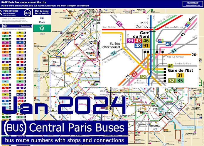
Paris bus route maps and timetables with city street plans
Most Paris buses are run by RATP and below you can discover over 500 bus lines arranged by bus number, name and line colour also overview bus maps, street plans, timetables and transport connections that cover the city and the suburbs going into the Paris region. This provides a comprehensive bus network giving you access to well over 12,000 bus stops, making this is a great way of getting around using public transport in Paris.
The above route map of Paris buses is the standard bus guide in PDF format, which can be downloaded and viewed on your smart phone, iPad, tablet or laptop helping you find the right bus when travelling around Paris.
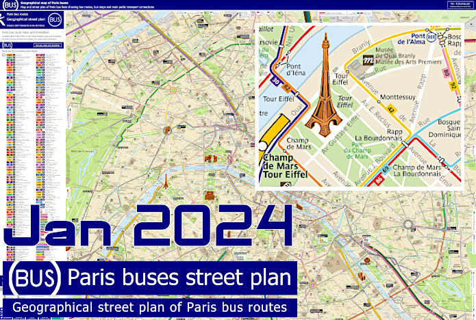
Geographical street plan of Paris buses with bus routes, bus stops and transport connections
Now this route map of Paris buses also includes over 12,000 bus stops on a street plan of Paris that will help you find your way around the city as well, but this is a larger file compared to the standard bus map, yet you can also download this for your mobile device or PC.